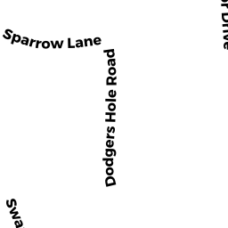
20 SMITH HOLLOW DR
Owner Information
SMITH THOMAS L & ALISON M
20 SMITH HOLLOW DR
EDGARTOWN,, MA 02539


Property Details
20 SMITH HOLLOW DR is classified as a Single Family Residential (Cape cod).
The primary structure on this property was built in 1992. There are 3,708ft2 of built area within this property. There is 1,862ft2 of residential/living space within this property. This property is listed as having 6 rooms.
20 SMITH HOLLOW DR is valued at $813,000. The land is valued at $374,800 and the structures are valued at $431,300. There is an additional valuation of $6,900 on this property.
This property is in Zone R60. Confirm with local Zoning Board authorities to ensure there are no overlays or other easements on this property.
The most recent deed for 20 SMITH HOLLOW DR is recorded at the local registrar in Book 0043, Page 0345. 20 SMITH HOLLOW DR was last sold on Monday, December 30, 1991 for $47,000.
Assessment data from fiscal year 2022.
Flood Data
According to the FEMA National Flood Hazard Layer, this property does not appear to be in a flood zone. It may also be in an area not yet reviewed. Nonetheless, confirm this information prior to taking any action.
To view the flood hazards around this property, create a FEMA "Firmette" Map of the area around 20 SMITH HOLLOW DR.
Broadband Internet Providers
| Provider | Type | Bandwidth (mbps) | |
|---|---|---|---|
| Viasat Inc | Satellite | 35 | 3 |
| HughesNet | Satellite | 25 | 3 |
| GCI Communication Corp. | Satellite | 0 | 0 |
| T-Mobile | Fixed Wireless | 25 | 3 |
| Comcast | Cable | 1000 | 35 |
| Verizon New England Inc. | DSL | 5 | 0 |
| VSAT Systems, LLC. | Satellite | 2 | 1 |
Broadband service provider data from December 2020.
Adjacent Properties
- 20 LOVEWELL WAY
Vacant, Selectmen or City Council (Municipal) owned by EDGARTOWN TOWN OF - 20 LOVEWELL WAY
Electric Generation Plants, Transition Value owned by CF CVEC OWNER LLC (LESSEE) - 24 SMITH HOLLOW DR
Multiple Houses on one parcel owned by BRUGUIERE W ERIK & HOLLY K - 14 SMITH HOLLOW DR
Single Family Residential owned by SCHRECK SUSAN R